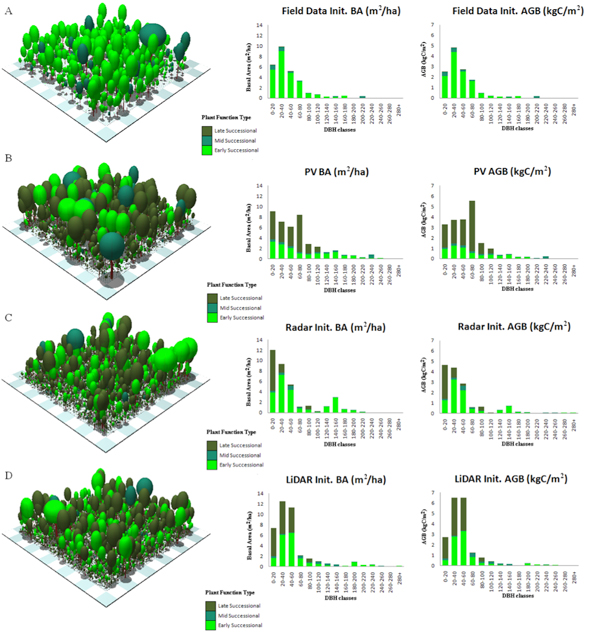
 There are uncertainties in regional and global terrestrial carbon budgets due to the current state heterogeneity of forest ecosystems, the dynamics of carbon storage, and the changes in forest ecosystems resulting from disturbance and recovery processes. Therefore, consistent measurements of canopy structure and forest attributes such as canopy height, vegetation age, trunk diameter and height, canopy gap, aboveground biomass, and species identification amongst others, may help in providing information regarding the current state forest structure that is vital for assessments of current and future forest sustainability, biodiversity, and terrestrial carbon budgets.
Lidar and radar remote sensing techniques are capable of these measurements and are powerful tools in determining forest structure. FAS researchers are investigating these techniques separately and also fused at the signal and parameter level to extract 3D forest structure and biomass at a variety of distinct ecosystems. The uncertainties in determining these parameters at different scales and spatial heterogeneity are quantified by simulating regional carbon fluxes an
d performing sensitivity analyses using the Ecosystem Demography (ED) model. The goal of this research is to assimilate lidar and radar remote sensing measurements of vegetation structure into the ED biosphere model in order to improve predictions of log-term vegetation responses to climate change. With this information the two active remote sensing techniques will be considered for global coverage on a spaceborne mission concept.
Faculty:
Prof. P. Moorcroft

